AN INDEPENDENT LES MISÉRABLES FIELD GUIDEFOR THE CURIOUS. THE MOVED. THE HIGH-NOTE ENTHUSIASTS.
LesMisNotesA LES MISÉRABLES FIELD GUIDE
21 / PLACES BEYOND THE PAGE

Places beyond the page.

A photo journey through real places named in Victor Hugo’s novel.

REAL PLACES. LIVES IMAGINED BY HUGO.

Step out of the book.
Keep it with you.

Some places are Hugo’s inventions. Other streets were there before him and outlived his characters. Nine stops at places named in the novel: photographs, history and the story that makes an address hard to forget.

Open the geographic map →
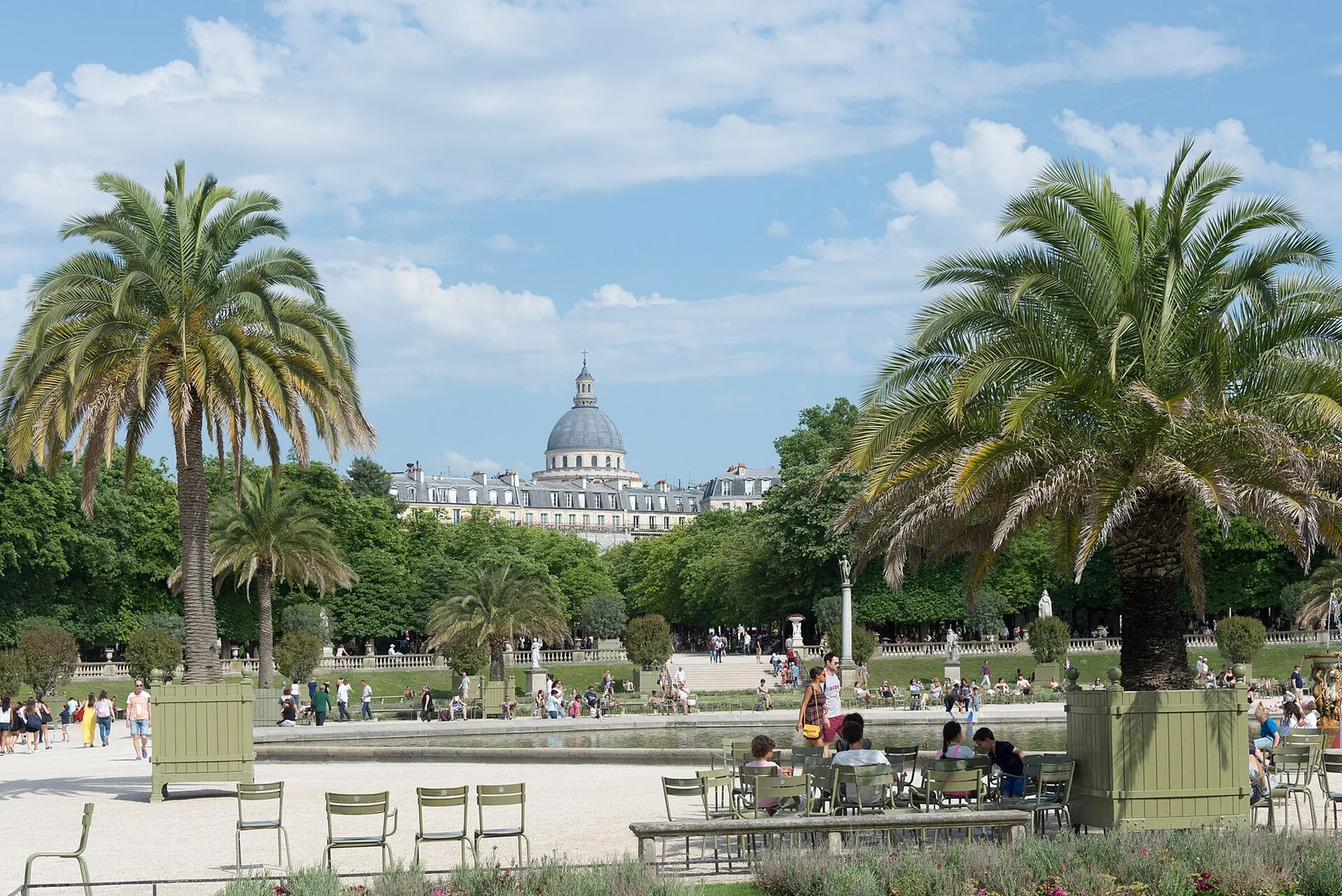
Green chairs, palms and garden terraces at the Luxembourg Gardens, with the Panthéon in the distance.
The Luxembourg Gardens in 2017, looking toward the Panthéon. A present-day view of a garden named in the novel. xiquinhosilva (opens in a new tab) ↗ · CC BY 2.0 (opens in a new tab) ↗ · resized and converted to WebP
Image and licence detailsParis 75006 Jardin du Luxembourg Bassin 20170527.jpg (opens in a new tab) ↗
Creator: xiquinhosilva
Whole frame retained; resized and converted to WebP for web delivery. No content editing, colorization, reconstruction, retouching, or cropping.
The displayed licence applies to this image.
HOW TO READ THIS JOURNEY

These places come from the novel, rather than a filming-location itinerary. A present-day photograph is not proof of how a place looked in 1832: every stop marks what survives, what changed and what can only be located approximately. Plot paragraphs follow your separate spoiler choice.

Green chairs, palms and garden terraces at the Luxembourg Gardens, with the Panthéon in the distance.
The Luxembourg Gardens in 2017, looking toward the Panthéon. A present-day view of a garden named in the novel. xiquinhosilva (opens in a new tab) ↗ · CC BY 2.0 (opens in a new tab) ↗ · resized and converted to WebP
Image and licence detailsParis 75006 Jardin du Luxembourg Bassin 20170527.jpg (opens in a new tab) ↗
Creator: xiquinhosilva
Whole frame retained; resized and converted to WebP for web delivery. No content editing, colorization, reconstruction, retouching, or cropping.
The displayed licence applies to this image.
Find this place on the map →
01 / 09 Surviving garden · altered layout

Luxembourg Gardens

A public garden, a private universe.

THE PLACE, BEFORE THE STORY

Luxembourg Gardens began as part of Marie de’ Medici’s palace project in the early seventeenth century. The French Senate’s history traces repeated changes to their layout, through the work of the Haussmann era. Hugo’s references to the old nursery and Rue de l’Ouest orient readers within that historical landscape. Today’s paths still invite an unhurried public stroll, while the garden around them tells a story of centuries of change. Marius’s repeated visits turn that everyday routine into the beginning of a love story.

THE NOVEL CONNECTION · SPOILERS

The next paragraph enters the events and characters’ fates. You can keep exploring the history without opening it.

The pin marks Luxembourg Gardens. Their layout has changed since the novel’s period.
Sources, exact chapters and marker placement

The place in history

The place in the novel

The pin marks Luxembourg Gardens. Their layout has changed since the novel’s period.

Full-text links can reveal spoilers. References use part · book · chapter rather than page numbers that vary between editions.
Back to the place index ↑
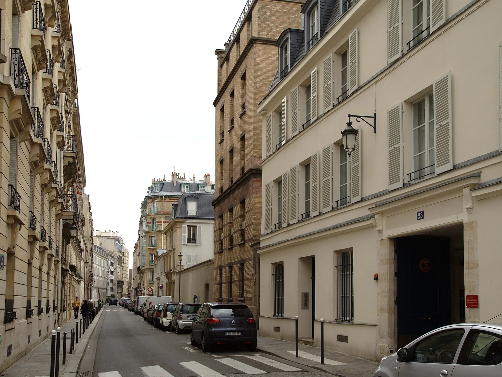
A narrow Paris street lined with pale façades, shutters and parked cars.
Rue Oudinot in 2012, photographed eastward from Rue Monsieur: the historical Rue Plumet. Ralf.treinen (opens in a new tab) ↗ · CC BY-SA 3.0 (opens in a new tab) ↗ · resized and converted to WebP
Image and licence detailsParis rue oudinot2.jpg (opens in a new tab) ↗
Creator: Ralf.treinen
Whole frame retained; resized and converted to WebP for web delivery. No content editing, colorization, reconstruction, retouching, or cropping.
The displayed licence applies to this image.
Find this place on the map →
02 / 09 Historic street · renamed

Rue Plumet, now Rue Oudinot

A real street around an invented refuge.

THE PLACE, BEFORE THE STORY

A Paris street name can send a reader to a different neighborhood. Hugo’s historical Rue Plumet is now Rue Oudinot in the seventh arrondissement; today’s Rue Plumet lies in the fifteenth. Municipal heritage records preserve the connection between the names. Within this urban framework Hugo places a secluded pavilion, an overgrown garden and a discreet second exit. The photograph shows the surviving street; the fictional house adds a layer of secrecy, sheltering Valjean while opening the way to Cosette’s new world.

THE NOVEL CONNECTION · SPOILERS

The next paragraph enters the events and characters’ fates. You can keep exploring the history without opening it.

Hugo’s Rue Plumet is today’s Rue Oudinot in the seventh arrondissement. The modern Rue Plumet lies in the fifteenth. Valjean and Cosette’s house and garden belong to the novel.
Sources, exact chapters and marker placement

The place in history

The place in the novel

Hugo’s Rue Plumet is today’s Rue Oudinot in the seventh arrondissement. The modern Rue Plumet lies in the fifteenth. Valjean and Cosette’s house and garden belong to the novel.

Full-text links can reveal spoilers. References use part · book · chapter rather than page numbers that vary between editions.
Back to the place index ↑
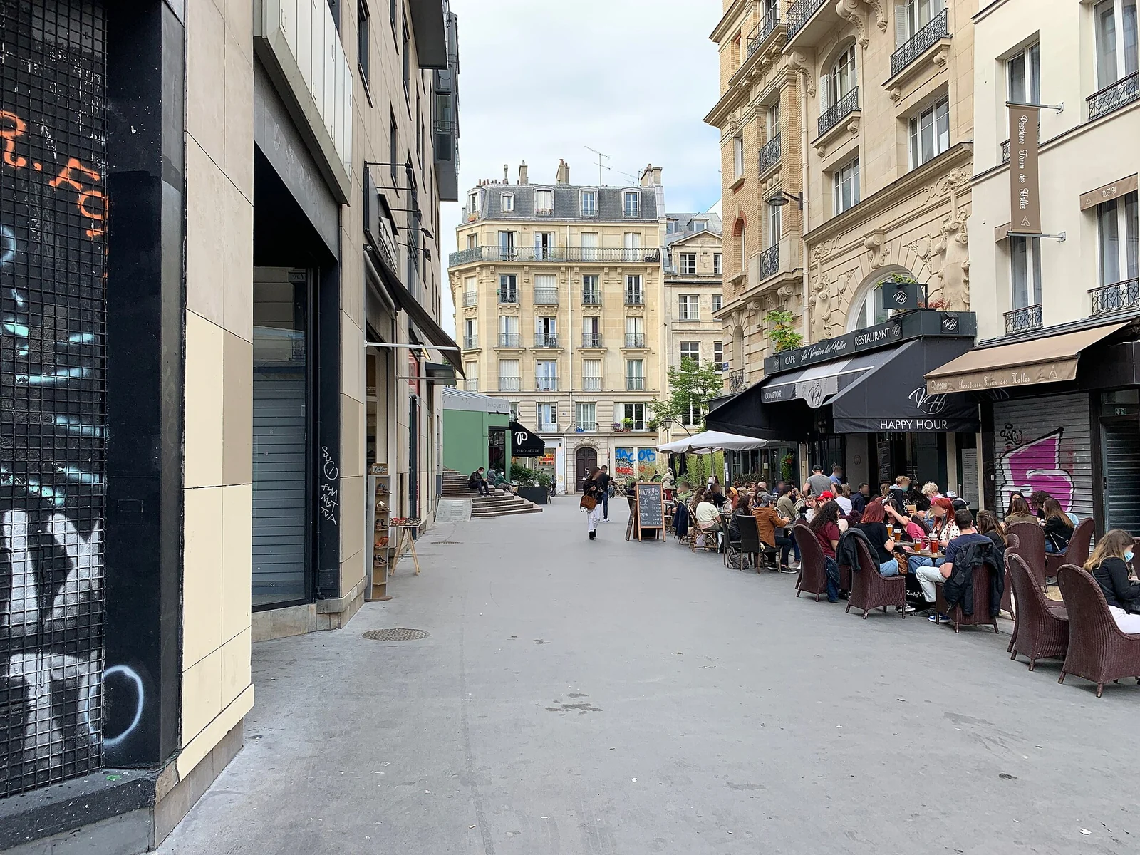
A pedestrian street with café terraces on Rue Mondétour in present-day Paris.
Rue Mondétour in 2021, near the vanished Rue de la Chanvrerie. Chabe01 (opens in a new tab) ↗ · CC BY-SA 4.0 (opens in a new tab) ↗ · resized and converted to WebP
Image and licence detailsRue Mondétour - Paris I (FR75) - 2021-06-05 - 1.jpg (opens in a new tab) ↗
Creator: Chabe01
Whole frame retained; resized and converted to WebP for web delivery. No content editing, colorization, reconstruction, retouching, or cropping.
The displayed licence applies to this image.
Find this place on the map →
03 / 09 Lost street · approximate area

Rue de la Chanvrerie

Read the missing street beneath the present one.

THE PLACE, BEFORE THE STORY

The Rue de la Chanvrerie was real, but its old alignment disappeared into the rebuilding around Rue Rambuteau. Hugo already describes that disappearance in the novel: he asks readers to reconstruct a cramped tangle of streets that his own contemporaries could no longer see intact. Municipal heritage research around 102 Rue Rambuteau records surviving fabric from the older neighborhood, without making today’s streets a preserved stage set. The photograph shows nearby Rue Mondétour as it is now. The lost urban density must be supplied by the text.

THE NOVEL CONNECTION · SPOILERS

The next paragraph enters the events and characters’ fates. You can keep exploring the history without opening it.

The pin marks the Rue Mondétour/Rue Rambuteau area, near the vanished Rue de la Chanvrerie, where Hugo places Corinthe and the barricade.
Sources, exact chapters and marker placement

The place in history

The place in the novel

The pin marks the Rue Mondétour/Rue Rambuteau area, near the vanished Rue de la Chanvrerie, where Hugo places Corinthe and the barricade.

Full-text links can reveal spoilers. References use part · book · chapter rather than page numbers that vary between editions.
Back to the place index ↑
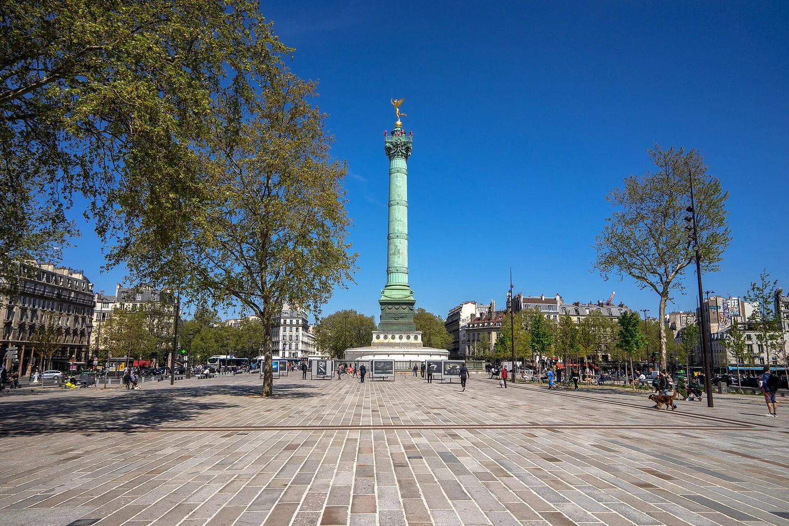
The July Column rises above the broad paved Place de la Bastille, framed by trees and Parisian buildings.
Place de la Bastille in April 2021, with the July Column. Guillaume Flament (opens in a new tab) ↗ · CC BY-SA 4.0 (opens in a new tab) ↗ · resized and converted to WebP
Image and licence detailsPlace de la Bastille, avril 2021.jpg (opens in a new tab) ↗
Creator: Guillaume Flament
Whole frame retained; resized and converted to WebP for web delivery. No content editing, colorization, reconstruction, retouching, or cropping.
The displayed licence applies to this image.
Another view: historical context
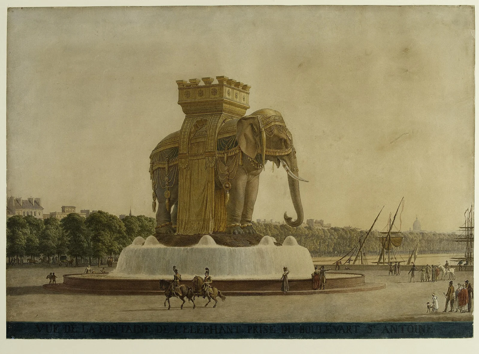
A period watercolor of a monumental elephant fountain with a howdah, basin, pedestrians and canal boats.
Jean-Antoine Alavoine’s 1814 architectural watercolor for the elephant fountain at the Bastille. Jean-Antoine Alavoine (opens in a new tab) ↗ · CC0 1.0 (opens in a new tab) ↗ · resized and converted to WebP
Image and licence detailsLa fontaine de l'éléphant, place de la Bastille, D.8274(2).jpg (opens in a new tab) ↗
Creator: Jean-Antoine Alavoine
Whole frame retained; resized and converted to WebP for web delivery. No content editing, colorization, reconstruction, retouching, or cropping.
The displayed licence applies to this image.
Find this place on the map →
04 / 09 Square survives · elephant demolished

Place de la Bastille & the lost elephant

Imperial ambition, seen from a child’s height.

THE PLACE, BEFORE THE STORY

Napoleon’s projected elephant fountain for the Bastille was never completed in its intended bronze form. A full-size plaster model became a real, decaying presence in the square before its removal in 1846. The July Column belongs to a different commemorative story: it was inaugurated in 1840 for the dead of the July Revolution of 1830. Dates are especially important here, since 1789, 1830 and the novel’s 1832 uprising are not interchangeable. The historical design shown here records an ambition, rather than a monument you can still walk around.

THE NOVEL CONNECTION · SPOILERS

The next paragraph enters the events and characters’ fates. You can keep exploring the history without opening it.

This is a reference point for the present-day square. The elephant is gone; the essay also includes an architectural design from 1814.
Sources, exact chapters and marker placement

The place in history

The place in the novel

This is a reference point for the present-day square. The elephant is gone; the essay also includes an architectural design from 1814.

Full-text links can reveal spoilers. References use part · book · chapter rather than page numbers that vary between editions.
Back to the place index ↑
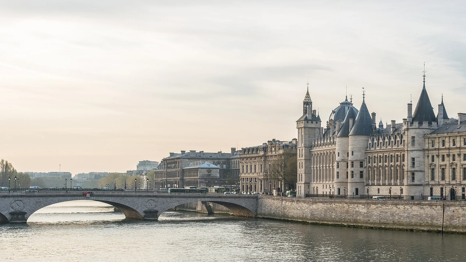
Pont au Change crossing the Seine beside the Conciergerie, viewed from Pont Neuf.
Pont au Change and the Conciergerie in 2014. The present bridge was built in 1860, after the novel’s period. DXR (opens in a new tab) ↗ · CC BY-SA 4.0 (opens in a new tab) ↗ · resized and converted to WebP
Image and licence detailsPont au Change and Conciergerie, Paris 2 April 2014.jpg (opens in a new tab) ↗
Creator: DXR
Whole frame retained; resized and converted to WebP for web delivery. No content editing, colorization, reconstruction, retouching, or cropping.
The displayed licence applies to this image.
Find this place on the map →
05 / 09 Bridge rebuilt · narrative area nearby

Pont au Change & the Seine

Two neighboring bridges, one essential distinction.

THE PLACE, BEFORE THE STORY

Pont au Change links the right bank with the Île de la Cité. The city records its reconstruction in 1860, after the novel’s main action. The quays and nearby Pont Notre-Dame supply Hugo’s wider geography: he describes the reach between the two bridges and places Javert on the quay at the corner of Pont Notre-Dame. The present bridge helps orient us in this changed city, with the river still running through its center.

THE NOVEL CONNECTION · SPOILERS

The next paragraph enters the events and characters’ fates. You can keep exploring the history without opening it.

The pin marks today’s Pont au Change, rebuilt in 1860. Hugo places Javert’s scene on the quay at the corner of nearby Pont Notre-Dame.
Sources, exact chapters and marker placement

The place in history

The place in the novel

The pin marks today’s Pont au Change, rebuilt in 1860. Hugo places Javert’s scene on the quay at the corner of nearby Pont Notre-Dame.

Full-text links can reveal spoilers. References use part · book · chapter rather than page numbers that vary between editions.
Back to the place index ↑
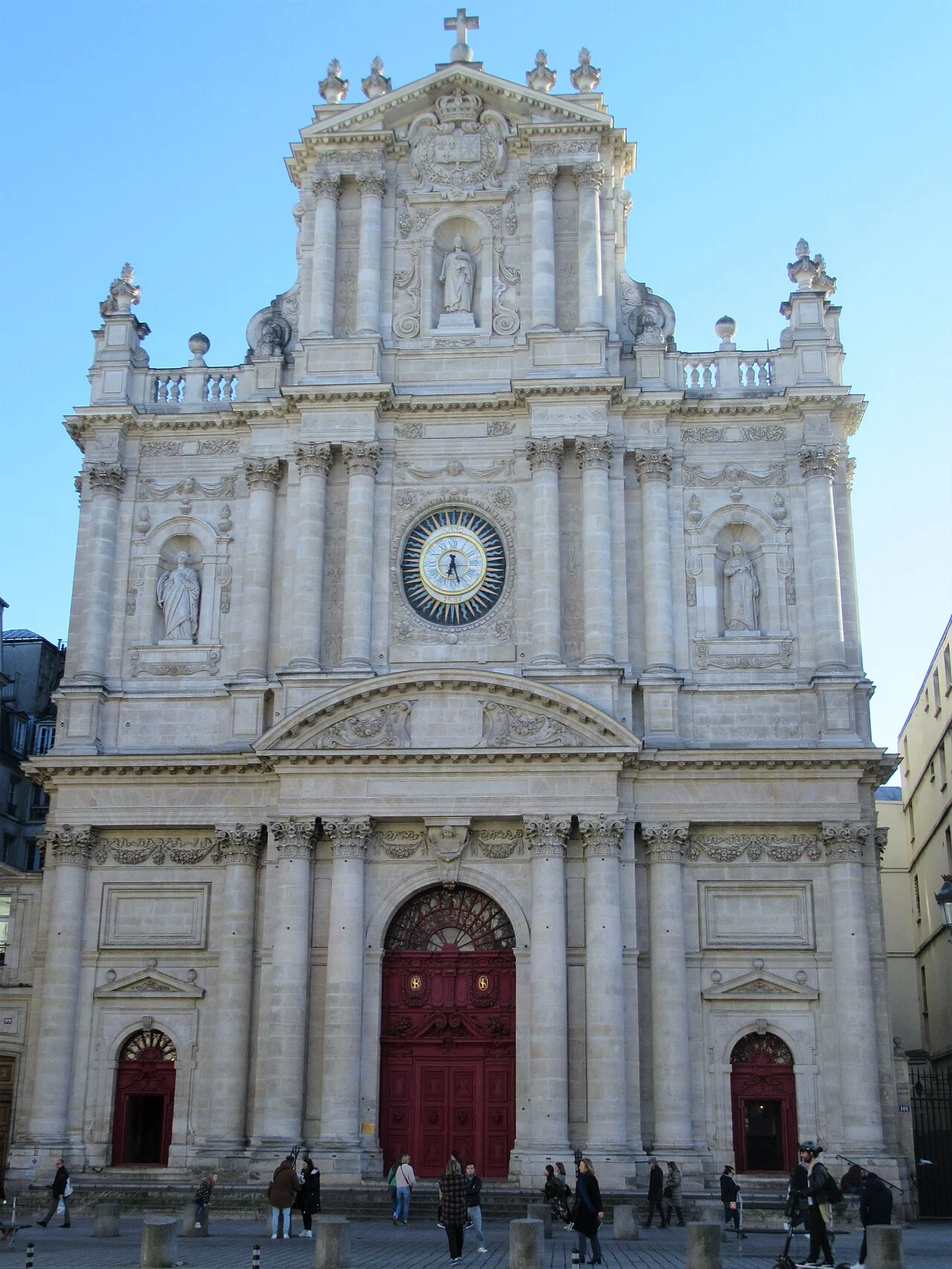
The pale stone Baroque façade and red doors of Saint-Paul-Saint-Louis beneath a blue sky.
The façade of Saint-Paul-Saint-Louis in 2023. The church is a surviving location explicitly named in the novel; this photograph shows its present-day appearance. Drycker (opens in a new tab) ↗ · CC BY-SA 4.0 (opens in a new tab) ↗ · resized and converted to WebP
Image and licence detailsParis Saint-Paul-Saint-Louis 2023-04-04.jpg (opens in a new tab) ↗
Creator: Drycker
Whole frame retained; resized and converted to WebP for web delivery. No content editing, colorization, reconstruction, retouching, or cropping.
The displayed licence applies to this image.
Find this place on the map →
06 / 09 Surviving church

Saint-Paul-Saint-Louis

A surviving building with a place inside the novel.

THE PLACE, BEFORE THE STORY

The church on Rue Saint-Antoine is a tangible survivor among these vanished streets and altered landscapes. Its seventeenth-century Jesuit architecture predates the novel’s setting; municipal heritage documentation traces the project from 1627 and the work of Étienne Martellange and François Derand. The building is included here because it is named in the novel, not simply because Hugo knew it. Its present façade and interior belong to an active place of worship, so a visit is also an encounter with a living community rather than an empty literary set.

THE NOVEL CONNECTION · SPOILERS

The next paragraph enters the events and characters’ fates. You can keep exploring the history without opening it.

The pin marks the surviving church on Rue Saint-Antoine. Hugo calls it Saint-Paul and identifies its Jesuit origins.
Sources, exact chapters and marker placement

The place in history

The place in the novel

The pin marks the surviving church on Rue Saint-Antoine. Hugo calls it Saint-Paul and identifies its Jesuit origins.

Full-text links can reveal spoilers. References use part · book · chapter rather than page numbers that vary between editions.
Back to the place index ↑
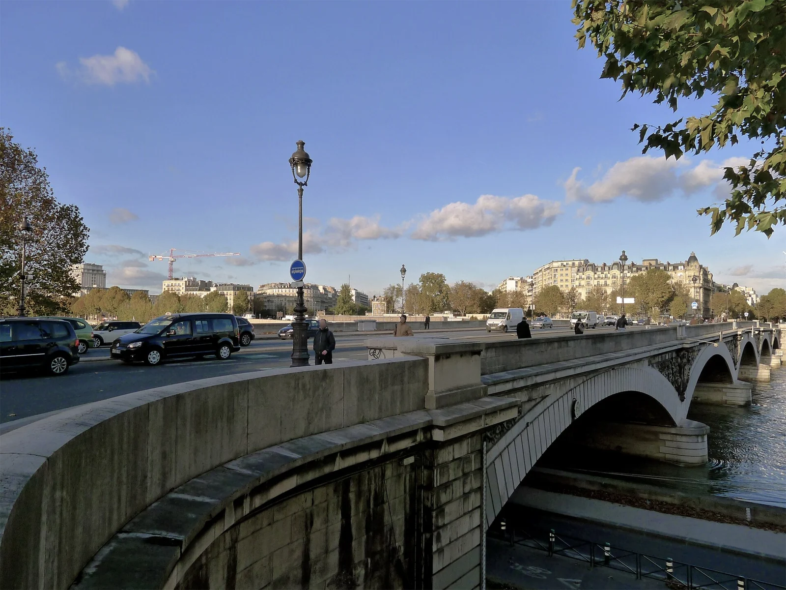
An oblique view of the stone arches and roadway of Pont d’Austerlitz across the Seine.
Pont d’Austerlitz in 2013. The present stone bridge postdates the novel’s setting. Mbzt (opens in a new tab) ↗ · CC BY-SA 3.0 (opens in a new tab) ↗ · resized and converted to WebP
Image and licence detailsP1210920 Paris V-XII-XIII pont Austerlitz rwk.jpg (opens in a new tab) ↗
Creator: Mbzt
Whole frame retained; resized and converted to WebP for web delivery. No content editing, colorization, reconstruction, retouching, or cropping.
The displayed licence applies to this image.
Find this place on the map →
07 / 09 Historic crossing · rebuilt bridge

Pont d’Austerlitz

A crossing where ordinary city rules become suspense.

THE PLACE, BEFORE THE STORY

Pont d’Austerlitz crosses the Seine near the Jardin des Plantes and the Arsenal side of the city. It is easy to treat a bridge as a fixed object, but here continuity belongs to the crossing more than to the structure. A medal in the Musée Carnavalet commemorates its reconstruction in 1854, well after the episode Hugo places here. The photograph therefore locates the action without reproducing its built environment. The distinction matters: a place can remain geographically recognizable while its stones belong to another chapter of history.

THE NOVEL CONNECTION · SPOILERS

The next paragraph enters the events and characters’ fates. You can keep exploring the history without opening it.

The river crossing is real. The current masonry bridge dates from a rebuilding in 1854, after the novel’s main period.
Sources, exact chapters and marker placement

The place in history

The place in the novel

The river crossing is real. The current masonry bridge dates from a rebuilding in 1854, after the novel’s main period.

Full-text links can reveal spoilers. References use part · book · chapter rather than page numbers that vary between editions.
Back to the place index ↑
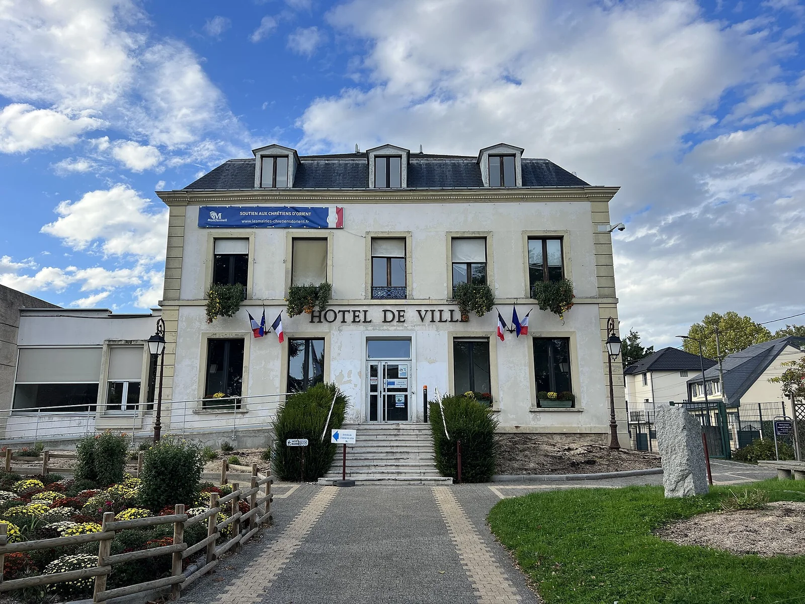
The pale façade of Montfermeil town hall, with French flags, a central entrance and planted beds beneath a cloudy blue sky.
Montfermeil’s town hall in October 2022: the novel’s town today. Chabe01 (opens in a new tab) ↗ · CC BY-SA 4.0 (opens in a new tab) ↗ · resized and converted to WebP
Image and licence detailsHôtel Ville - Montfermeil (FR93) - 2022-10-23 - 2.jpg (opens in a new tab) ↗
Creator: Chabe01
Whole frame retained; resized and converted to WebP for web delivery. No content editing, colorization, reconstruction, retouching, or cropping.
The displayed licence applies to this image.
Another view: historical context
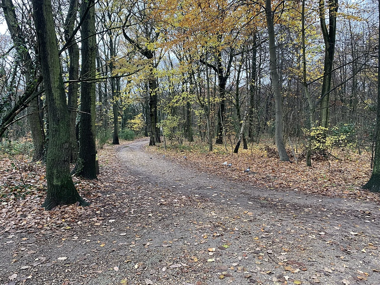
A curving woodland path beneath tall trees and late-autumn leaves in Bondy Forest.
Bondy Forest in 2020, photographed in Clichy-sous-Bois, next to Montfermeil. Chabe01 (opens in a new tab) ↗ · CC BY-SA 4.0 (opens in a new tab) ↗ · resized and converted to WebP
Image and licence detailsForêt Régionale Bondy - Clichy-sous-Bois (FR93) - 2020-12-12 - 8.jpg (opens in a new tab) ↗
Creator: Chabe01
Whole frame retained; resized and converted to WebP for web delivery. No content editing, colorization, reconstruction, retouching, or cropping.
The displayed licence applies to this image.
Find this place on the map →
08 / 09 Real town · transformed landscape

Montfermeil

Beyond Paris, a landscape measured in the weight of a bucket.

THE PLACE, BEFORE THE STORY

Hugo introduces Montfermeil through topography and a practical shortage: a village on a plateau needs water brought uphill. The town east of Paris has changed greatly since the novel’s rural setting. Its municipal history records how a local spring became known as the Fontaine Jean-Valjean after the novel’s success, followed by later restoration and redesign. The story left its mark on local place names. The town-hall photograph shows Montfermeil today, while the forest view brings us back to the surrounding landscape in which Hugo imagines Cosette’s journey.

THE NOVEL CONNECTION · SPOILERS

The next paragraph enters the events and characters’ fates. You can keep exploring the history without opening it.

The pin marks Montfermeil at town scale; the town-hall photograph shows the town today.
Sources, exact chapters and marker placement

The place in history

The place in the novel

The pin marks Montfermeil at town scale; the town-hall photograph shows the town today.

Full-text links can reveal spoilers. References use part · book · chapter rather than page numbers that vary between editions.
Dinner at the Thénardiers’ inn: an imagined modern menu, inspired by foods in the novel →Back to the place index ↑
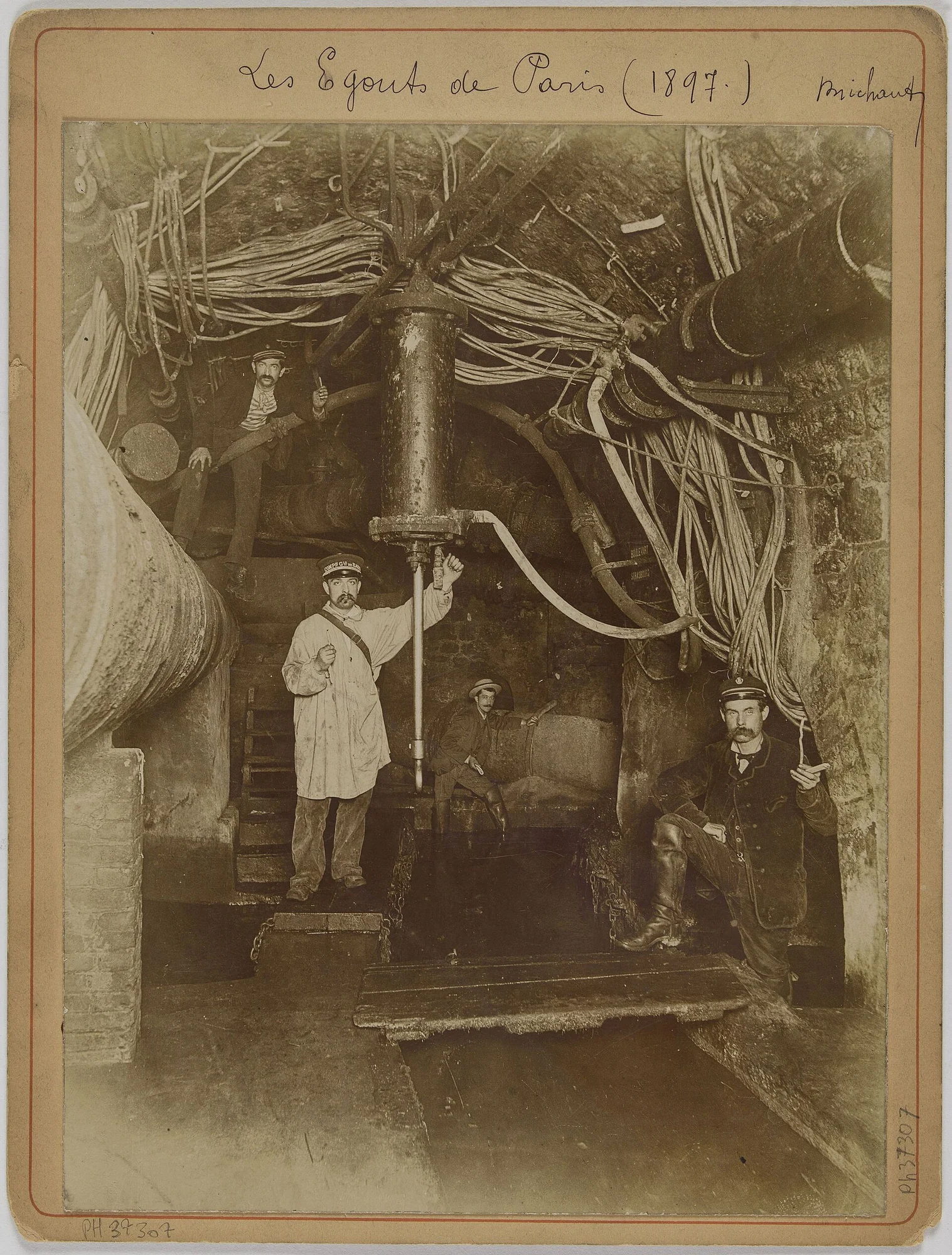
A mounted sepia photograph showing men, pipes and cables inside a Paris sewer tunnel.
Paris sewers photographed by Albert Brichaut in 1897, 65 years after the novel’s June 1832 events. Albert Brichaut (opens in a new tab) ↗ · CC0 1.0 (opens in a new tab) ↗ · resized and converted to WebP
Image and licence detailsLes égouts de Paris (1897), PH37307 (1 of 2).jpg (opens in a new tab) ↗
Creator: Albert Brichaut
Whole frame retained; resized and converted to WebP for web delivery. No content editing, colorization, reconstruction, retouching, or cropping.
The displayed licence applies to this image.
Find this place on the map →
09 / 09 Historic network · modern reference point

The Paris sewers

The city has another city underneath it.

THE PLACE, BEFORE THE STORY

Paris’s sewers form a city-scale network. The municipal sewer museum traces their transformation from an unhealthy drainage system into the expanded nineteenth-century network associated with engineer Eugène Belgrand. The 1897 photograph records that infrastructure decades after the novel’s 1832 action. The modern museum near Pont de l’Alma, marked on the map, opens a view into this underground city: a world of work and infrastructure sustaining the streets above. Hugo devotes an entire book within the novel to it.

THE NOVEL CONNECTION · SPOILERS

The next paragraph enters the events and characters’ fates. You can keep exploring the history without opening it.

The pin marks the modern sewer museum, a starting point for exploring the network beneath Paris. The photograph dates to 1897.
Sources, exact chapters and marker placement

The place in history

The place in the novel

The pin marks the modern sewer museum, a starting point for exploring the network beneath Paris. The photograph dates to 1897.

Full-text links can reveal spoilers. References use part · book · chapter rather than page numbers that vary between editions.
Back to the place index ↑

Now, connect the places.

A few kilometres separate two places. Sometimes one chapter separates two worlds.

Back to the map →
YOUR CHOICE

Reveal the whole story?

Enabling spoilers reveals identities, relationships, deaths and the ending on story, character and comparison pages. You can hide them again, but you cannot unread a revelation.

Remember for next time?

Browse without optional storage or analytics. Choose whether to remember preferences and progress or allow usage measurement.

What does this include?
YOUR CHOICES

Privacy, in plain sight

Your choice is remembered for 180 days. Change it at any time from the footer. Spoiler consent remains separate.

Necessary for operation · The privacy-choice record and explicit spoiler choices in this tab.

Turning remembering off stops using existing saved data. To remove it from this device too:

Erase saved data from this device?

This removes only this guide’s saved language, listening checkmarks, bookmarks, last journey and quiz round. The site cannot restore them. Privacy choices stay, and remembering turns off. It does not erase data already sent to an external provider or files you shared or downloaded.